Simulation One radio tracking a drone, frame by frame
8 m/s crossing
A drone crossing at 8 m/s, detected and tracked by one radio.
  • ~40×faster with targeted ray launching
  • 1kmsimulated range, open sky
  • 10airframe models
  • 11simulated surroundings

About

Can one communication radio, listening to the echoes of its own 5G-like signal, detect a drone and read its spinning blades? A ray-traced digital twin built with NVIDIA Sionna RT.

Ray tracing
How it works Rays from the radio meet the body and the turning blades, then bounce off.

Model

Turntable
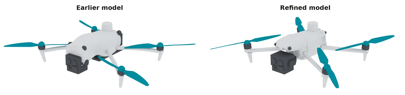
Refined model A commercial quadcopter model, refined and frozen for all new runs. Rotor spin slowed for display.
Two renders of the same quadcopter from the same angle. Left, the earlier model: a smooth, rounded shell and simple blades. Right, the refined model: a detailed shell around the nose and camera mount, and slimmer, twisted blades.
Update Rotors on their own tilted motor axes, twisted and cambered blades, a detailed shell.
Close-up
Rotor A twisted, cambered blade on its tilted motor axis.
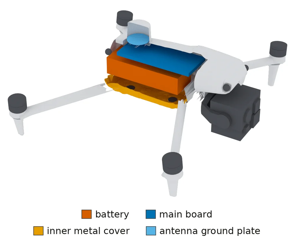
Render of the refined model from above at the front right, with the right half of the shell removed and the blades hidden: an orange battery, a blue main board on top of it, a yellow inner metal cover beneath and a small light-blue antenna plate in the top turret. A legend names the four parts.
Inside Battery, boards and a metal cover inside the shell.
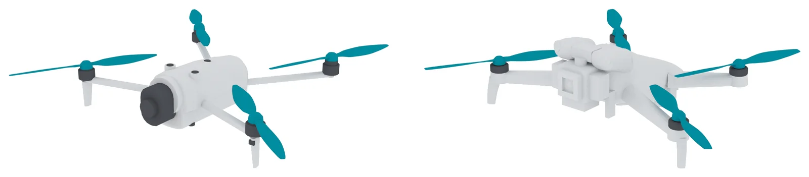
Two renders side by side of smaller folding quadcopter models, light grey with dark motors and teal blades: on the left a model with a rounded body and a large round camera at the front, on the right a model with a slim body and a boxy camera mount under the nose. No markings or text.
Other airframe models Two smaller folding quadcopter models, refined from published imagery.

In motion

8 m/s fly-in
Fly-in Fly-in from 50 m to 11 m: the track locks on.
100 frames
Detection A drone hovering at 15 m: 100 frames with and without it.

Signatures

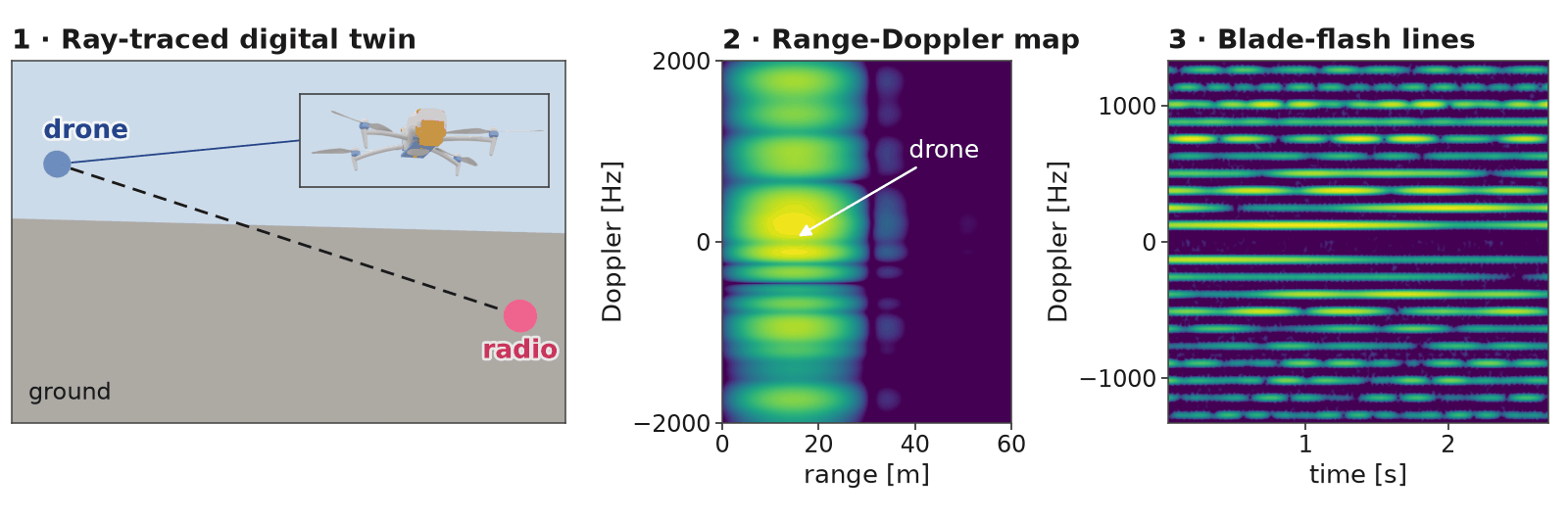
Three panels. First, a rendered outdoor scene: a blue marker labelled drone hovers in the sky on the left, a pink marker labelled radio sits just above the grey ground on the right, a dashed line of sight joins them, and an inset shows the quadcopter model. Second, a range-Doppler heat map in which the drone appears as bright horizontal bands at short range. Third, a spectrogram of Doppler over time with many evenly spaced horizontal lines above and below zero.
Overview A hovering drone: scene, range-Doppler map, blade-flash lines.
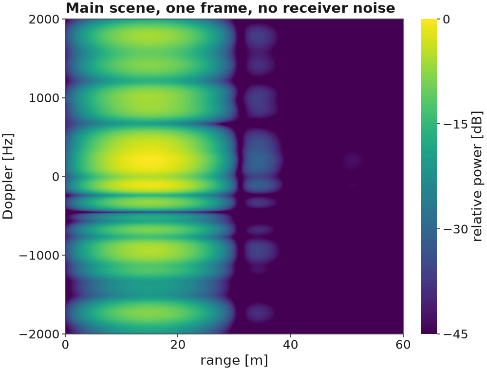
Range-Doppler heat map with range on the horizontal axis and Doppler on the vertical axis. Bright horizontal bands, strongest just above zero Doppler, fill a stretch of short ranges where the drone is; farther ranges are dark.
Range-Doppler A hovering drone at its range, spread in Doppler by the blades.
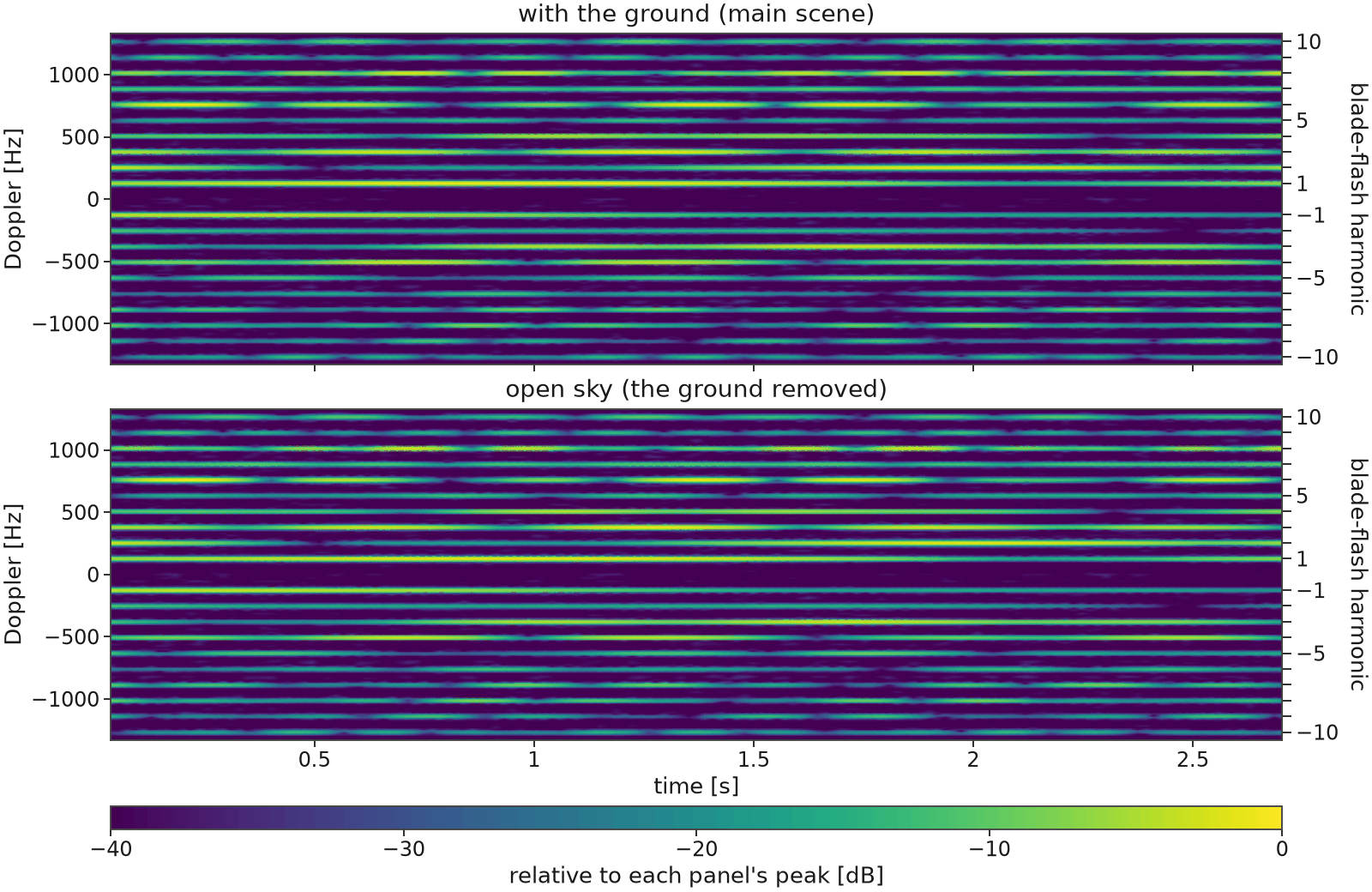
Two stacked spectrograms of Doppler frequency versus time, one with the ground and one in open sky. Both show many evenly spaced horizontal lines above and below a dark band at zero Doppler, and the two panels look nearly the same. A right-hand axis numbers the lines as blade-flash harmonics.
Micro-Doppler Blade-flash lines, with and without the ground.
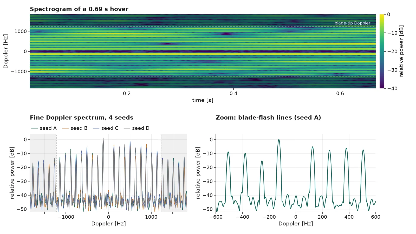
Top: a spectrogram of Doppler versus time over a 0.69 second hover, showing many evenly spaced horizontal blade-flash lines between two dashed blade-tip lines. Bottom left: a fine Doppler spectrum where four overlaid seeds show a comb of sharp lines, with the region beyond the blade-tip Doppler shaded. Bottom right: a zoom from minus 600 to plus 600 hertz showing smooth, sharp lines about 125 hertz apart.
Blade lines A longer record gives sharp blade-flash lines.
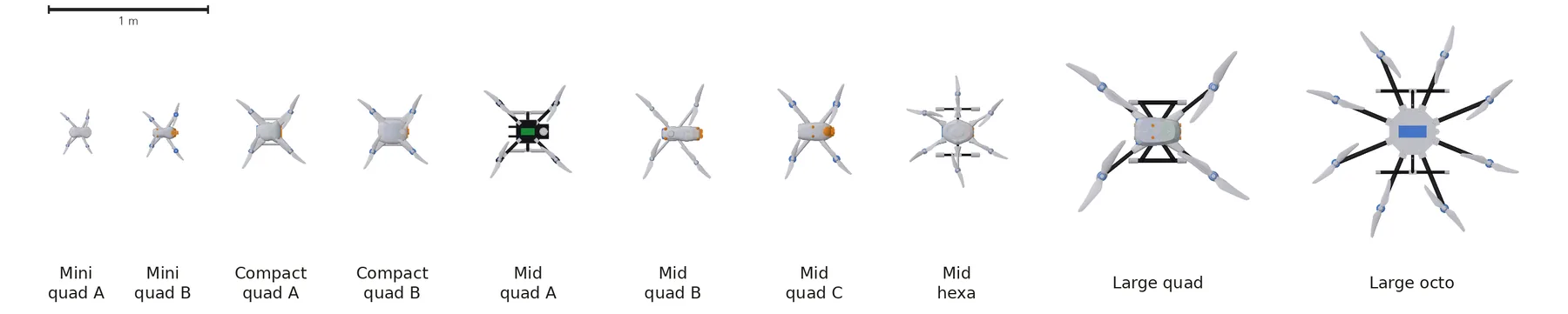
Top views of ten simplified drone models at one shared scale with a 1 metre scale bar, labelled by size and rotor count: mini quads A and B, compact quads A and B, mid quads A, B and C, a mid hexacopter, a large quad and a large octocopter, growing from about 20 centimetres to about 1.3 metres across.
Airframes Ten airframe models at true relative size.

Places

Fly-over
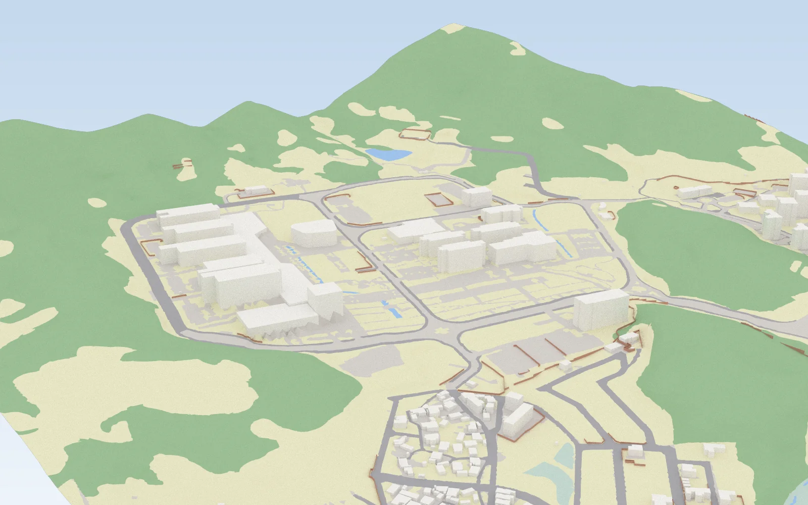
Our campus DGIST, rebuilt as a ray-traceable scene.
Oblique render of the campus scene under a pale sky: pale box-shaped buildings inside a ring road, grey roads and thin brown walls; the ground is coloured by material, with green forest floor covering the hills, pale yellow dry ground, light grey built ground around the buildings, a small blue pond and a dense village in the foreground.
How it is built Public national map data give building footprints and heights, roads, walls and bare-earth terrain; the ground now carries radio materials from a land-cover map.
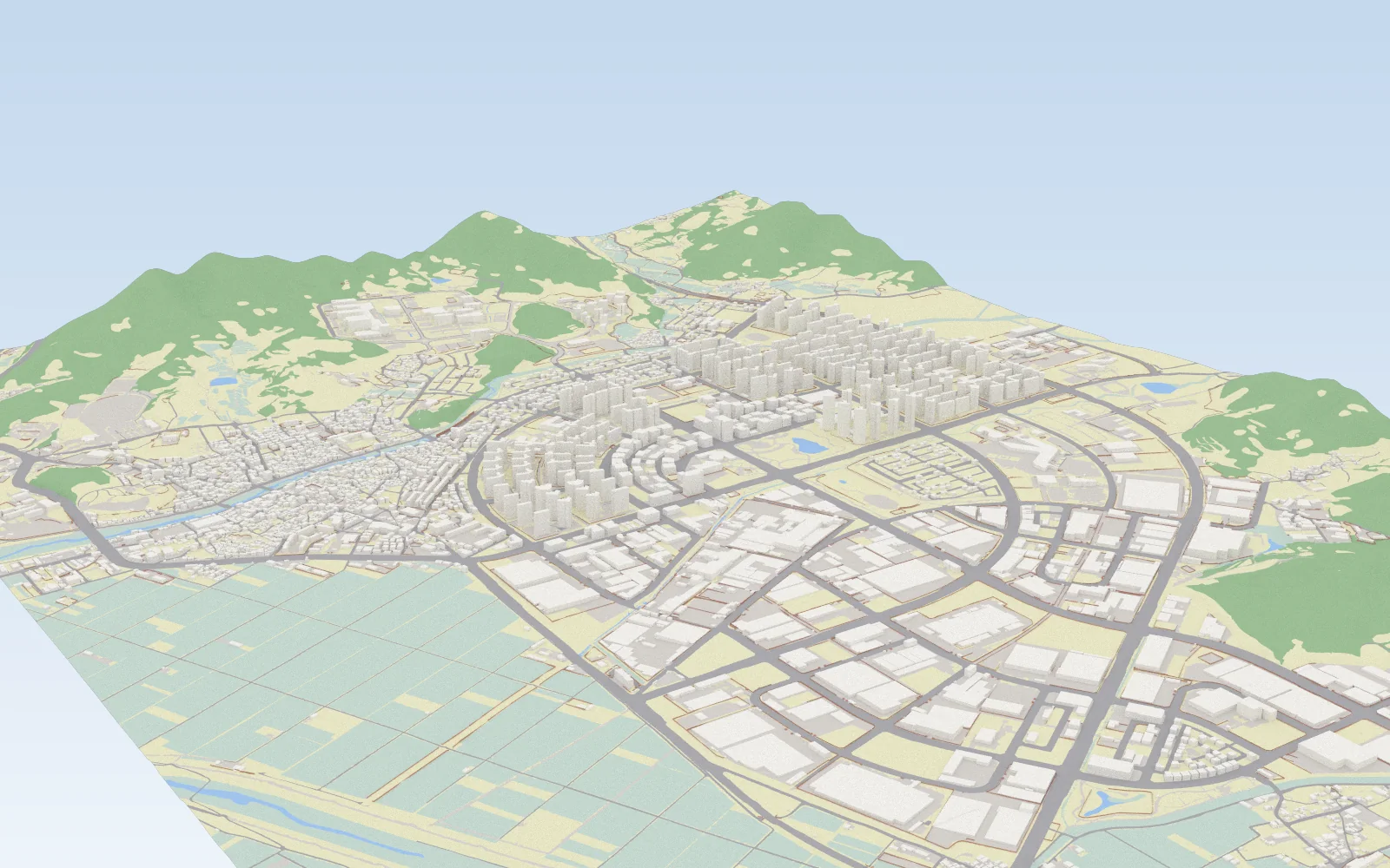
Oblique render of the wider district scene: rows of tall apartment towers and a curved road ring in the middle, an old town on the left and large industrial halls in the foreground; the ground is coloured by material, with pale green-grey rice paddies in the lower left, green forest on the hills, a blue river and ponds, and pale yellow dry ground between the buildings.
District The surrounding district: apartment towers, old town, industrial zone and rice paddies.

Ground colours buildingsroadsbuilt grounddry groundwet ground / paddiesforest floorwater

Building data: MOLIT GIS Building Integrated Information (VWorld); NGII 1:5,000 digital topographic map; land cover: Ministry of Climate, Energy and Environment EGIS level-3 land-cover map; terrain comparison: Copernicus DEM GLO-30.
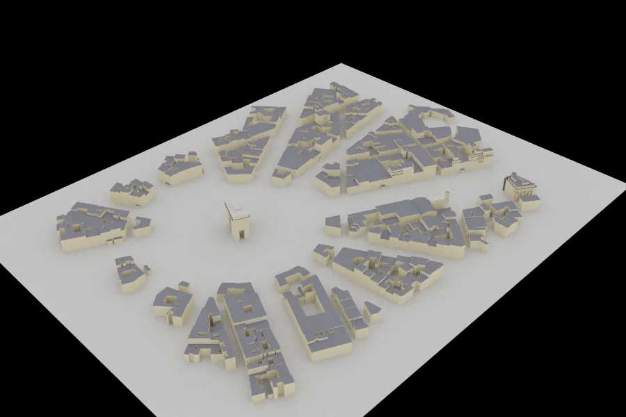
Rendered city model seen from above at an angle: blocks of buildings radiating around a large circular plaza (Paris, Étoile).
City Paris, Étoile
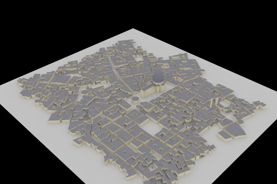
Rendered city model of dense old-town blocks with narrow streets and a domed cathedral near the centre (Florence).
City Florence
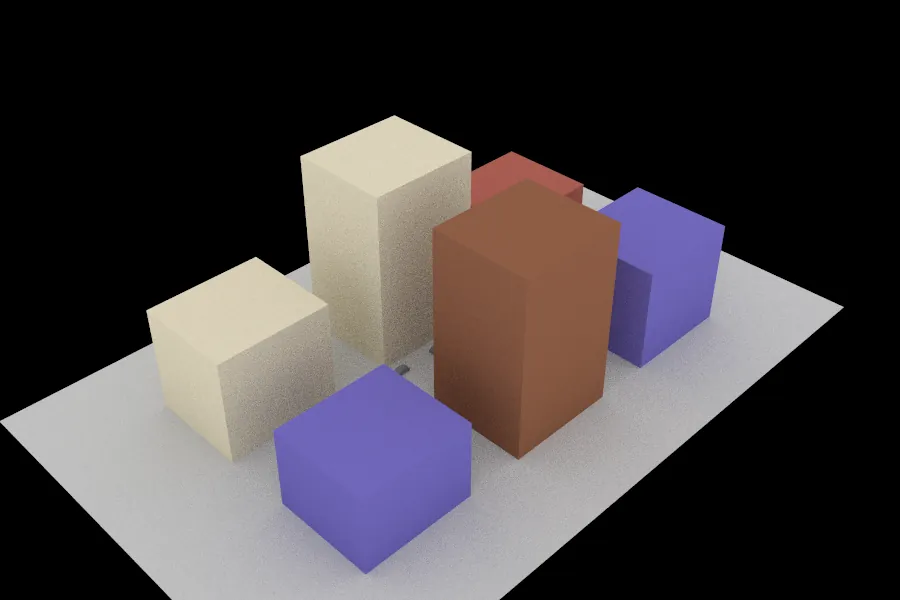
Rendered street canyon: six tall coloured box buildings in cream, brown, red and purple lining a street.
City Street canyon with cars
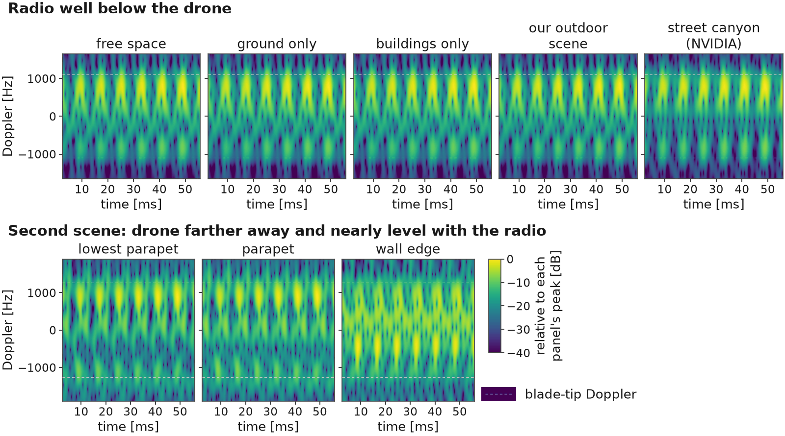
Eight spectrograms of Doppler versus time, all with the constant echo removed, with thin dashed blade-tip lines. First group, radio well below the drone: free space, ground only, buildings only, our outdoor scene and the NVIDIA street canyon all show nearly the same evenly spaced blade flashes inside the dashed lines. Second group, the second scene: the lowest parapet and the parapet show clean repeating flashes on both sides of zero, and the wall edge, which hides half of the drone, shows a visibly different, uneven pattern.
Eight signatures Still surroundings change little; hiding half the drone changes a lot.
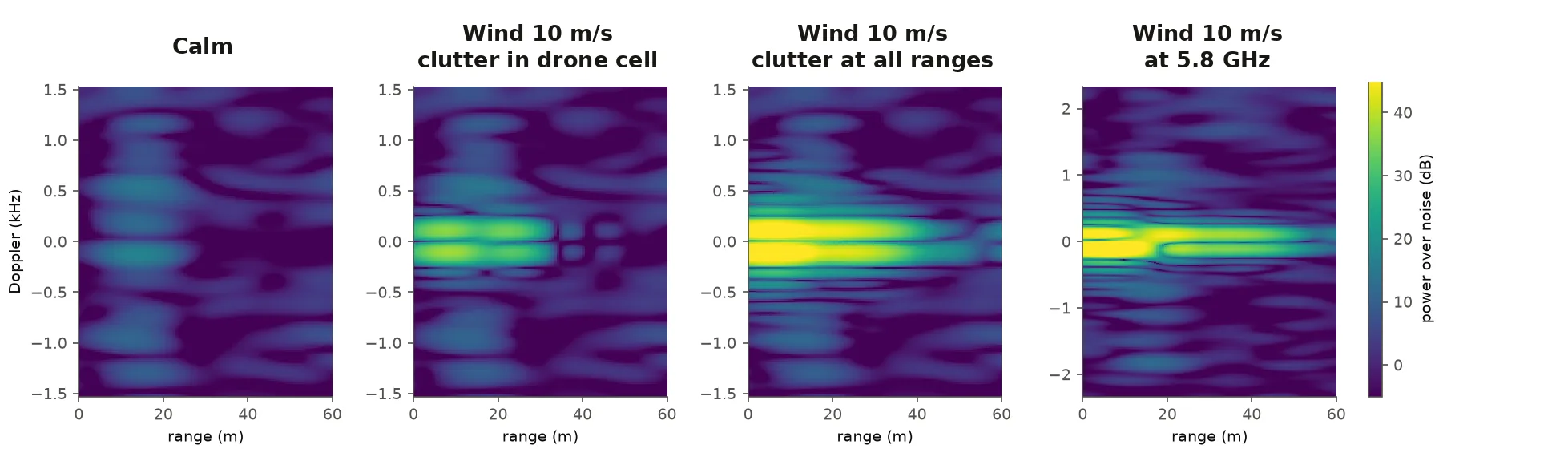
Four range-Doppler maps; the drone sits at about 15 metres. Calm: faint bands at the drone's range. Wind 10 metres per second with clutter in the drone's range cell: a bright band hugging zero Doppler at short ranges. Wind with clutter at all ranges: the band stretches along the whole range axis. At 5.8 gigahertz: a similar band on a wider Doppler axis.
Wind Wind-blown vegetation smears clutter near zero Doppler.

Speed & range

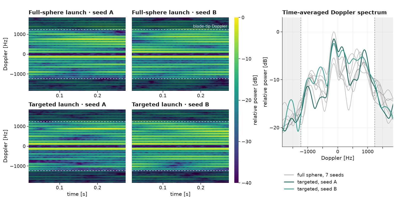
Four spectrograms of Doppler versus time and a line plot. Top row: full-sphere launch with two random seeds; bottom row: targeted launch with two random seeds. All four show the same evenly spaced blade-flash lines between dashed blade-tip lines. The line plot overlays the time-averaged Doppler spectra: seven grey full-sphere curves and two teal targeted curves that follow the same envelope.
Targeted launch Same echo level and Doppler spread as a full-sphere launch, up to ~40× faster.
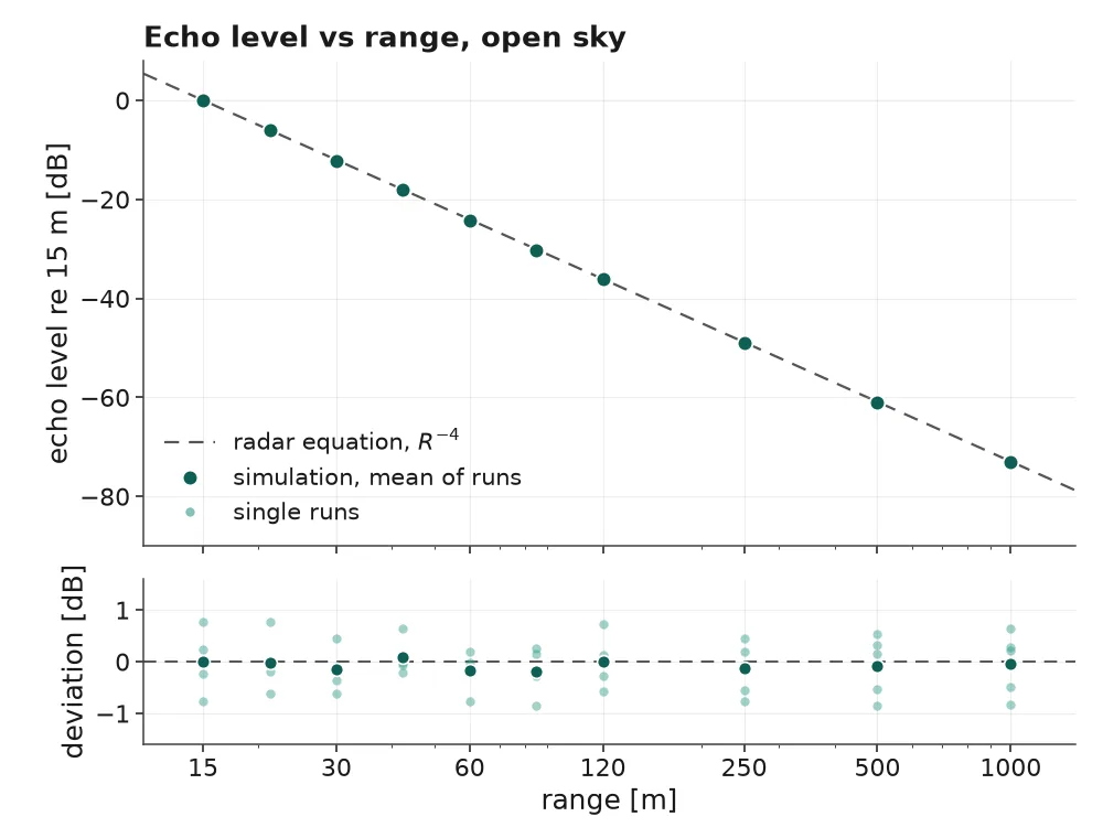
Line plot of echo level versus range on a logarithmic axis from 15 metres to 1 kilometre in open sky. Dots for the mean of several simulation runs lie on a dashed radar-equation line falling as range to the minus fourth power; a strip below shows single-run deviations within about plus or minus one decibel.
Long range Up to 1 km in open sky, on the radar-equation trend.
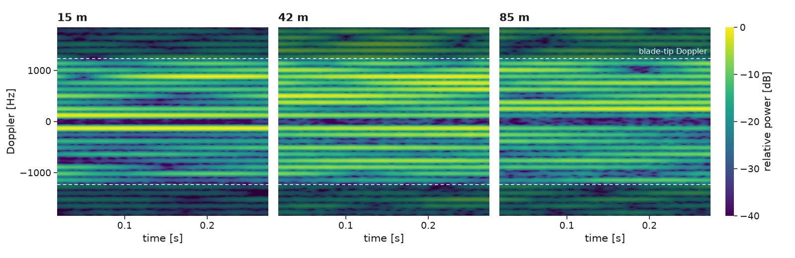
Three spectrograms of Doppler versus time for the same hovering drone in open sky at 15, 42 and 85 metres, each showing evenly spaced blade-flash lines between dashed blade-tip lines; the pattern looks much the same at every range.
Farther Same signature at 15, 42 and 85 m.
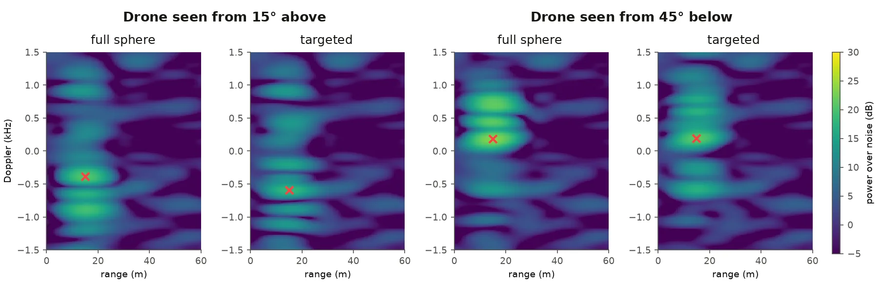
Four range-Doppler maps with a colour bar of power over noise. Two geometries, drone seen from 15 degrees above and from 45 degrees below, each run with a full-sphere and a targeted launch. A red cross marks the detection, at the drone's range for both launches.
Detection Both launches detect the hovering drone in the same range cell.

Status

Ongoing, unpublished research. All results are simulated with an idealised radio front end. The drone model has been refined and frozen, and a small field measurement is being prepared. The campus and district scenes are our own; the other city scenes are NVIDIA Sionna RT built-ins.